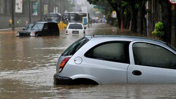
Flood Control Plan for Gurugram (2020-21) by Department of Revenue & Disaster Management
- By
- Gurugrampost
- September-14-2022

The country's cyber city Gurugram suffers huge losses every year due to flash floods when it rains. The city has gained international fame in a short span of time for being the corporate offices and IT hub of big companies but after achieving this modernity there is hardly a year which has remained untouched by the floods or flash floods. Even in Aug, 2020, the city sunk due to it's limited drainage capacity, which results in Badshahpur drain overflowing during heavy rains, disruption of the hydrological flow of natural drains, which has stopped the flow of water into traditional dams, and delayed monsoon preparedness were some of the main reasons of this man-made disaster.
In view of all these circumstances, an action plan has been prepared by the Revenue and Disaster Management Department of Haryana Government to deal with the floods for the year 2020-21. We will discuss the important information related to it here..
Gurugram District Profile
Gurugram District falls in the southern most region of the state of Haryana. Its headquarters is at Gurugram. It lies in between the 27° 27’ 20” and 28° 32’25’’ latitude, and 76° 39’ 39’’ and 77° 20’ 50’’ longitude. Being in the vicinity of Delhi, Gurugram falls under National Capital Region. On its north, it is bounded by the District of Jhajjar and National Capital Territory of Delhi; Faridabad District lies to its east; Palwal District lies to its south east. On south it shares boundaries with Mewat whereas Rewari lies to its west. To its South, lies the state of Rajasthan. The District spreads over 1254 sq. km.
About 77 per cent of annual rainfall in the District is received during the monsoon months. The normal annual rainfall in Gurugram District is about 596 mm spread over 28 days. The south west monsoon sets in the last week of June and withdraws towards the end of September and contributes about 85% of the annual rainfall. July and August are the wettest months. 15% of the annual rainfall occurs during the non-monsoon months in the wake of thunder storms and western disturbances.
1. Drainage System of the District
The drainage of the District is typical of the arid and semi arid areas. The important depression in the level of the district in this region is Najafgarh Lake. Sabi and Indrori are two important seasonal streams of the district.
i) Areas under Sabi River
Sabi River is a powerful seasonal stream originating in the Aravali ranges falling in District Jaipur of Rajasthan and after travelling a distance of about 80 miles in Jaipur and Alwar Districts of Rajasthan, it enters Rewari Distirct in Haryana from the south -eastern directions and then runs towards Pataudi Tehsil of Gurugram District. Sabi is notorious for flashfloods as it flows on ground level and keeps on changing its course every year.
Apart from causing extensive damage in Pataudi Tehsil, Sabi Nadi also affects and inundates a number of villages of Gurugram Tehsil falling near Najafgarh Jheel area. This is because of the fact that when River Sabi and river Yamuna are simultaneously inspate, the Najafgarh drain starts back
flowing causing accumulation of large quantity of water in Najafgarh Jheel. Spread of water in Najafgarh Jheel affects about 15 villages of Tehsil Gurugram for example, Jhanjrola, Mankrola, Ikbalpur, Kherki Majra, Chandu Budhera, Dharampur, Daultabad Jahazgarh, Kaliwas, Sultanpur, etc.
ii) Areas under Indori River
Another source of flood in this area is Indori river. This is also a hill torrent which orginates in the hilly tract of Rajasthan falling between Tauru and Tijara. This rivulet enters Haryana near Tauru (in Mewat District) and after crossing Delhi-Jaipur National Highway near village Sidhrawali, it ultimately joins Sabi river beyond Pataudi.
During the season of heavy rain-fall in the catchment area, there is always a danger of breach of these bandhs which results in flooding of about 20 villages of Pataudi Tehsil. From the year 1983-84 there is no accumulation of water in Dharuhera Bandh and no such threat of water or flood from this river wrong has happened so far.
iii) Details of Link Drains
(I) Nathupur - Falling in to Najafgarh drain
(II) Parasoli - downstream of village Budhera.
(III) Kaliyaka - It covers Bijupur, Baikhera
(IV) Outfall channel of RD63015 GC and Sarhol, Village of tehsil B.garh and village Sarmathla
(V) Badshahpur- Tehsil Gurugram.
(VI) Sultanpur
(VII) Mohamadpur Link Drain
3.) Flood Risk in the District
The main cause of floods in the District can be attributed to the heterogeneous topography of the District. It consists of hillocks, valleys, big and small land-locked depressions and undulated terrain. Another interesting feature of the topography of the District is that no perennial river flows through it. However, there are a number of "Barsati Nallahs/hill torrents, that criss-cross the entire District. Besides these, rapid urbanization in the District has also lead to heavy pressure of infrastructural development over the natural drainage system, again leading to urban flooding.
Flood prone area/vulnerable villages in the District
i) Dangerously exposed Areas

ii) List of Villages likely to be marooned

iii) Moderately exposed areas

iv) Urban areas


4.) Flood Preparedness
Department wise flood preparedness activities have been identified which are given below. It is also mentioned here that all the flood preparedness activities should be supervised by the concerned Deputy Commissioner.
i) Activities related to Revenue Department /Office of Deputy Commissioner
1. Trainings and Mock Drills - Imparting trainings to all the concerned officers and staff on disaster management, SOPs etc shall be ensured.
2. Inspection- Inspection of Relief Stocks, Rescue Equipments and submit report to the Government.
3. Evacuation Plan- Prepare an evacuation plan for the flood prone areas.
4. Joint Inspection - Conduct Joint Inspection of flood prone areas in the District.
5. Inspect, Repair and Check culverts on railway lines in liaison with railways.
6. Flood Control Order- Preparation and review of Flood Control Order as per the format provided vide this office letter no ER-CBO-2015/4584 dated 17.04.2015. The updated Flood Control Order should be submitted at the State level by 15th May, 2020.
7. Circulation of Flood Control Order to all concerned offices, officers and Staff.
8. Liaison- Establish Liaison with army, railways, voluntary agencies, NGO’s at local level.
9. Posting of Staff required for duty in flood affected areas touring and familiarizing with the area under charge of each of the officers in coordination with the concerned departments.
10. Search and Rescue Teams- The village level committee of concerned Patwari, Gram Sachiv, ANM, Asha Worker, Anganwari Worker and concerned Teacher of the school may be constituted for rural area and similar teams consisting of Councilors concerned Patwari, ANM, Anganwari worker, concerned Teacher, Tehsildar/Naib Tehsildar be constituted for the cities.
11. Temporary Shelters & Relief Camps- Identify the Safe School buildings/ Dharamshalas and other community structures for organizing relief camps for person evacuated from low lying areas. Review the adequacy of these shelters in the District. So, that those could be used in the event of floods for relocating peoples where seems necessary.
12. Pre- Contract- Prepare a list of relief material required in bulk during emergency response based on past experiences. It is also advised to enter into pre contract for the items which are not available within your jurisdiction to ensure the timely available of relief items.
13. Coordination- Co-ordination with the adjoining District and state be got made on daily basis so that advance information about the floods could be received well in time.
14. Identification of Nodal Officers- Prepare a list of nodal officer in various departments of the District. The name, designation, telephone nos, Fax no and Email Address of identified nodal officer is to be prepared, printed and circulated to all concerned.
ii) Activities related to Irrigation Department
15. Inspect & strengthen all flood protection embankments, ring bunds and other bunds.
16. Inspect all drains, link drains through responsible officers & remove congestion.
17. Test Pump Houses & Mobile pumps and complete necessary repairs.
18. Complete all ongoing works on link drains, ring bunds.
19. Stock sufficient quantities of sand bags, ballies & material at (a) all villages protected by ring bunds (b) flood protection works.
20. Check Flood Warning Systems.
21. Inspect, Repair and Check culverts on canals.
22. The State/District authorities to be fore-warned 02-03 days before a river actually start rising at particular place after watching the rain and the inflow in the rivers.
23. To check all the vulnerable & problem points which cause flooding during the previous year.
iii) Activities related to PWD (B&R) Department
24. Inspect & strengthen & repair all approach roads to villages to ensure that the roads will remain open during floods.
25. Inspect & strengthen and repair all culverts on village approach roads so that drainage is not obstructed.
26. Inspect, Repair and Check culverts on highways and District roads.
iv) Activities related to Police Department
27. Identify and organise Police Patrolling on canal banks, embankments, roads etc which are usually cut by villagers during floods.
28. Provide mobile wireless sets to villages likely to be cut off.
29. Check and Repair communication, teleprinters and wireless systems.
v) Activities related to Health Department
30. Stock sufficient quantity of Medicines and other medical stores at appropriate points
vi) Activities related to Animal Husbandry Department
31. Stock sufficient quantity of vaccine for cattle at appropriate points.
vii) Activities related to Public Health Department/ HUDA/ Urban Local Bodies
32. Stock sufficient quantity of Bleaching powders for disinfecting wells.
33. Supply of safe drinking water during crisis and transportation of drinking water.
34. Arrange adequate number of Pumps/hand pumps in villages/cities/town where wells/areas are likely to be flooded
35. Inspect Sewerage and storm channels of cities / town, remove congestion and obstructions, if any, and render them suitable for use in case of flooding.
viii) Activities related to Power Department
36. Inspection of Transmission lines, Electric poles etc. to ensure safety of people in flood marooned areas.
ix) Activities related to Food & Supplies Department
37. Identification of areas where floods are likely to cut off people from supply of essential commodities and making appropriate arrangements to ensure supply of food grains, kerosene oil, salt, edible oil and other necessities until the flood recede.
38. Any other activities which may help in mitigate the flood.
5.) Ongoing Flood Protection Scheme in District
It is expected that the city of Gurugram will face a flash flood or storm water flood owing to more than average rainfall as predicted by Indian meteorological Department. As a consequence the peak flow across and along Badshahpur drain is estimated to beapproximately 1500 cusecs. Further, cleaning up and clearing impediments for water flow at upstream locations like Ghata is going to add to the pace of the flow.
Conceding on these omissions following strategy is to be adopted so that general public suffers from least of the predicaments during the monsoon season the govt of Gurugram is fast approaching.
6.) Flood Action Plan
1. Set up of Flood Control Room
There shall be a Central Control Room at the District headquarters and the same shall be located in the Office of the District Revenue Officer at Mini Secretariat, Gurugram 2nd Floor. It will functional on Telephone No. 0124-2322877 (Office), 2304444 (R).

These Control Rooms shall function at all hours during the rainy seasons and duty rosters shall accordingly be prepared by respective Officers In-charge. A copy of the duty roster shall be sent to the Central Control Room daily. Arrangements shall be made in such a manner that there is always a person on duty in the Control Room.
2. Activities of Flood Control Room
A) Functions of Central Control Room
i. To receive flood warnings and other information through any source and to receive all messages/ instructions from the State Control Room and to pass it on to the Officer Incharge, who, if required, shall direct it to be passed on further to Sub Divisional Control Room and Tehsil control room.
ii. To convey flood situation reports to the Additional Chief Secretary-cum-Financial Commissioner, Revenue & Disaster Management, Govt. of Haryana, and Chandigarh in the proforma prescribed by the Government, every evening.
iii. To issue necessary directions and organizational details relating to evacuation and flood relief measures etc. The concerned SDMs, Tehsildars and other concerned officers wherever required.
iv. To maintain statements showing up-to-date flood situation in various parts of the District and convey the same to the officer-in-charge who in turn will take necessary orders from the Deputy Commissioner for timely action.
v. To arrange air droppings of food articles and other relief supplies marooned villages, the Deputy Commissioner shall requisite the help from the Air Force after consulting with the Chief Secretary, Revenue & Disaster Management, Govt. of Haryana, Chandigarh.
vi. To keep proper liaison with Army authorities for seeking Army help in evacuation operations and maintenance of means of communications, if necessary. For this purpose, the Deputy Commissioner shall contact the Commanding Officer, Gurugram Military Station.
B) Functions of Tehsil Control Room
These Control Rooms shall be equipped with necessary maps of their area showing vulnerable points. The functions of these Control Rooms are detailed here under:
i. To receive all information regarding flood situation in their respective areas from the sector officers.
ii. To receive all information pertaining to flood relief operations from the Central Control Room or any other source as to convey the same to the Sector officers and other officials /non official organizations as the case may be.
iii. To remain in touch with the work and requirement of sector officers and relief parties regarding evacuation and relief measure and also to place demand and obtain necessary instructions from the Officer In-charge, Central Control Room.
iv. To receive flood situation reports from various Sector Officers in their respective areas at the end of the day and send a comprehensive report covering all items to the Central Control Room by 6.00 P.M every day.
v. Issue directions regarding evacuation and supply of relief articles, medicare to human beings and cattle and all other precautionary measures according to flood situation prevailing in their respective areas.
C) Flood Warning System
District is regularly receivning Weather Forecasting Report from IMD Department via. Email, Whats app Group etc. Regarding Flash flood in River Sabi, it is the duty of XEN, JLN Water Services Divison Rewari to send a daily report to the Deputy Commissioner, Gurugram about the water level of Sabi River at Dharuhera Bridge.
D) Ring Bunds
1. Kherki Majra 2. Baluda 3.Iqbalpur 4.Dharampur 5.Mankraula 6.Sidhrauli 7.Sidhravli B.Ed.College 8.Mauzamabad 9.Khalilpur 10.Maniwas 11.Sherpur 12.Khentiawas 13.Balewa 14.Haqdarpur 15.Dadawas 16.Jataula 17. Sheikhpur Majra(to be maintained by BDPOs)
E) Responsibility of various concerned departments before, during and after flood
7.) Flood Resource Inventory
Flood Relief equipments and trained personnel in the District
i) List of equipment available within the District

ii) List of JCB available within the District


iii) List of Dewatering pumps available within the District

iv) List of officials trained in OBM Operations

v) List of Divers in the District

B. Impotant Telephone No’s
All the telephone no's related to managemnet are given in PDF, click here for more detailed information.
8.) Flood Budget Allocation for the year 2020-21
The Governor of Haryana is pleased to accord sanction for allocation of funds and to incur an expenditure of Rs. 99,00,000/- (Rupees ninety nine lacs only) with letter no. 606-ER-1- 2020/3107 Chandigarh dated 19-05-2020 for keeping as reserve to be used for areas of the state affected by Floods if any, during the year 2020-21 as per details given below:-
i) Budget details of State for flood

ARTICLE AND PICTURES SOURCE : Department of Revenue & Disaster Management FLOOD CONTROL ORDER DISTRICT GURUGRAM 2020-21
More from Environment
All that impacts the environment of Gurugram and helps secure water and air quality as life essential requirements.
गुरुग्राम फ़्लड - पहले जल निकासी की व्यवस्था हो बेहतर, उसके बाद ही सरकार करे पौराणिक सरस्वती नदी की खोज
यमुनानगर: एक तरफ मिलेनियम सिटी नाम से मशहूर हरियाणा के सबसे ज्यादा चमचमाते शहरों में से एक गुरुग्राम इस बरसाती पानी में डूबा जा रहा है. दूसर...
Read More
गुडगाँव का ड्रेनेज सिस्टम आखिर कबतक झेलेगा सिस्टम की मार!
गुडगाँव का ड्रेनेज सिस्टम आखिर कबतक झेलेगा सिस्टम की मार! बारिश शुरू होने से पहले गुडगाँव के बरसाती ड्रेन को दुरस्त करने के लिए कई स्तर पर ल...
Read More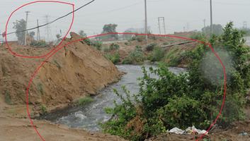
Gurgaon Sector 103(New Sectors) a natural drain about to be blocked
Gurgaon Sector 103(New Sectors) a natural drain about to be blocked. This is the reason why Gurgaon floods.This is how we treat our natural ...
Read More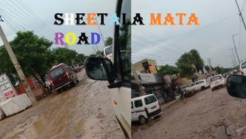
Gurgaon Floods - Who makes most of the floods
Gurgaon Floods create business opportunities for roads rebuilding and pumps, that's why it will keep happening every season. Who makes most ...
Read More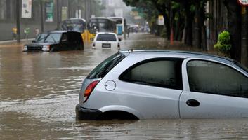
Why Gurgaon Floods, a report on watershed management and imminent dangers the city faces
वर्ष 2018 में चेन्नई में बरसात और बाढ़ से होने वाली विभीषिका को पूरे हिंदुस्तान ने देखा, साथ ही एक-एक बूँद पानी को तरसते महाराष्ट्र के लातूर ...
Read More
